
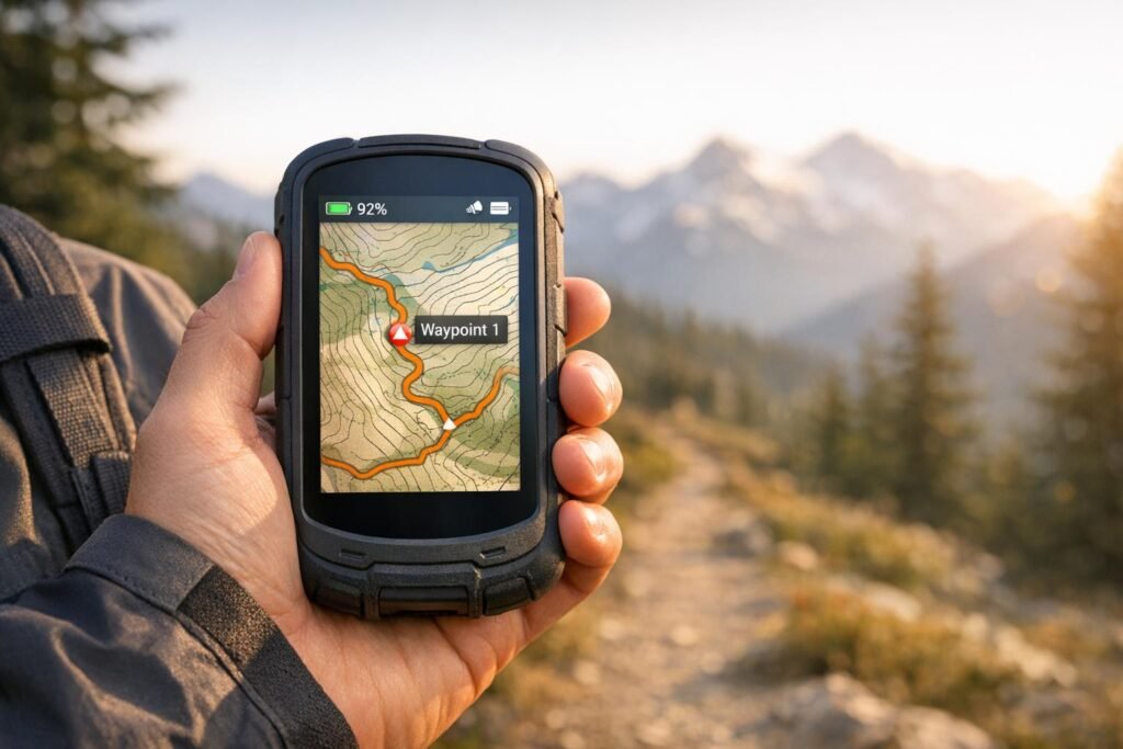
When you’re heading into the backcountry, your smartphone might not cut it. Dedicated GPS devices are designed for tough conditions, offering long battery life, rugged durability, and precise satellite connectivity – features your phone just can’t match. Whether you’re navigating dense forests, enduring extreme cold, or tackling multi-day hikes, these devices are built to keep you safe and on track.
Here’s a quick look at the top hiking GPS devices of 2025:
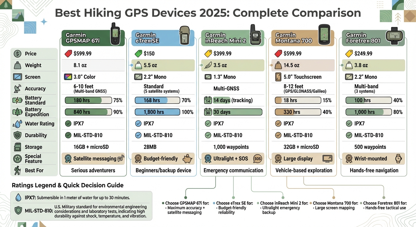
- Garmin GPSMAP 67i ($599.99): High accuracy (6-10 feet) with multi-band GNSS, 180-hour battery, and two-way satellite messaging.
- Garmin eTrex SE ($150): Budget-friendly, 1,800-hour expedition battery life, and simple breadcrumb navigation.
- Garmin inReach Mini 2 ($399.99): Lightweight (3.5 oz), satellite communication, and 14-30 day battery life for emergencies.
- Garmin Montana 700 ($599.99): Large 5-inch touchscreen, 18-hour battery, and robust mapping for off-road adventures.
- Garmin Foretrex 801 ($249.99): Wrist-mounted, 1,000-hour expedition battery life, and military-grade ruggedness.
Key Takeaways:
- Accuracy: Multi-band GNSS models (like the GPSMAP 67i) provide pinpoint precision even under heavy tree cover.
- Battery Life: Expedition modes on devices like the eTrex SE and Foretrex 801 can last weeks or months.
- Durability: All models meet MIL-STD-810 standards and are water-resistant (IPX7).
- Special Features: Satellite messaging (GPSMAP 67i, inReach Mini 2) and large displays (Montana 700) cater to specific needs.
For serious hikers, these devices are more than just tools – they’re a reliable backup when your phone fails. Read on for detailed reviews of each model.
Comparison of Top 5 Hiking GPS Devices 2025: Features, Battery Life, and Pricing
Top 5 Best Hiking GPS Devices in 2025 | Ultimate Guide for Outdoor Adventures
sbb-itb-5a98267
1. Garmin GPSMAP 67i
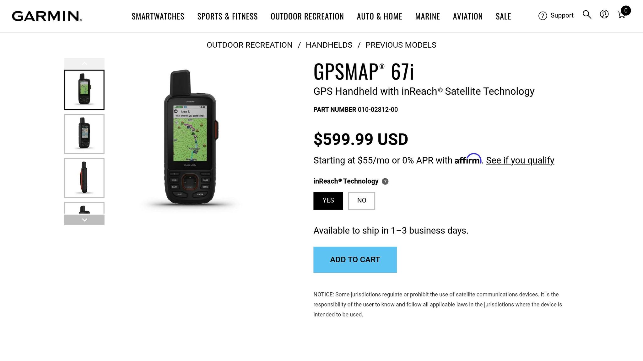
The Garmin GPSMAP 67i is built for adventurers who demand precision and durability in the backcountry. This top-tier handheld GPS blends advanced navigation, rugged construction, and satellite communication capabilities. At $599.99, it’s a serious tool for serious outdoor enthusiasts.
Navigation Accuracy and GNSS Support
The GPSMAP 67i stands out for its pinpoint accuracy. With a quad-helix antenna and dual-frequency (multi-band) technology, it supports six satellite systems: GPS, GLONASS, Galileo, QZSS, BeiDou, and IRNSS. This setup ensures it can connect to satellites in even the toughest conditions, like dense forests, in as little as eight seconds, with accuracy between 6 to 10 feet.
OutdoorGearLab’s lead tester highlighted its reliability:
"Thanks to its multi‑band technology, I found this unit maintained satellite connection even in less‑than‑ideal locations, like below dense forests and tree canopies or a tight slot canyon."
Preloaded maps and access to Bird’s Eye Satellite Imagery add to its versatility. With 16 GB of internal storage and a microSD card slot, you’ll have plenty of room for detailed maps.
These navigation capabilities are complemented by its impressive battery life.
Battery Life (Standard and Expedition Modes)
The 67i’s battery life is a key selling point. In standard GPS mode, it lasts up to 180 hours, or 165 hours with inReach tracking at 10-minute intervals. For extended trips, Expedition mode delivers up to 840 hours without tracking, or 425 hours with inReach enabled at 30-minute intervals. Many users report completing multi-day trips without needing to recharge. It uses a rechargeable lithium-ion battery and charges via USB-C, making it compatible with modern power banks and chargers.
Durability and Water Resistance
This device isn’t just accurate – it’s tough. Built to MIL-STD-810 military standards, it handles extreme temperatures, shocks, and water exposure. With an IPX7 water-resistance rating, it can survive being submerged in up to 1 meter (3.3 feet) of water for 30 minutes. Operating temperatures range from –4°F to 140°F (–20°C to 60°C). Weighing just 8.1 ounces (230 grams) and featuring a chemically strengthened glass lens, it’s designed to endure harsh conditions.
Display Readability and Usability
The GPSMAP 67i features a 3-inch sunlight-readable color display with a resolution of 240 x 400 pixels. Its button-operated interface works reliably even with gloves or in wet conditions – perfect for outdoor adventures. It also includes ABC sensors (altimeter, barometer, and compass) and integrates inReach technology for two-way satellite messaging and SOS alerts via the Iridium network. Subscriptions for inReach start at $14.99 per month. While the interface may take some getting used to compared to touchscreen models, many users value its dependability in extreme scenarios.
The GPSMAP 67i scored an 81/100 from OutdoorGearLab and an 8.8/10 from GearJunkie, with Amazon users giving it 4.5 out of 5 stars based on 337 reviews. While some users mention the steep price and complex menus, the device is consistently praised for its excellent battery life and fast satellite connectivity.
2. Garmin eTrex SE
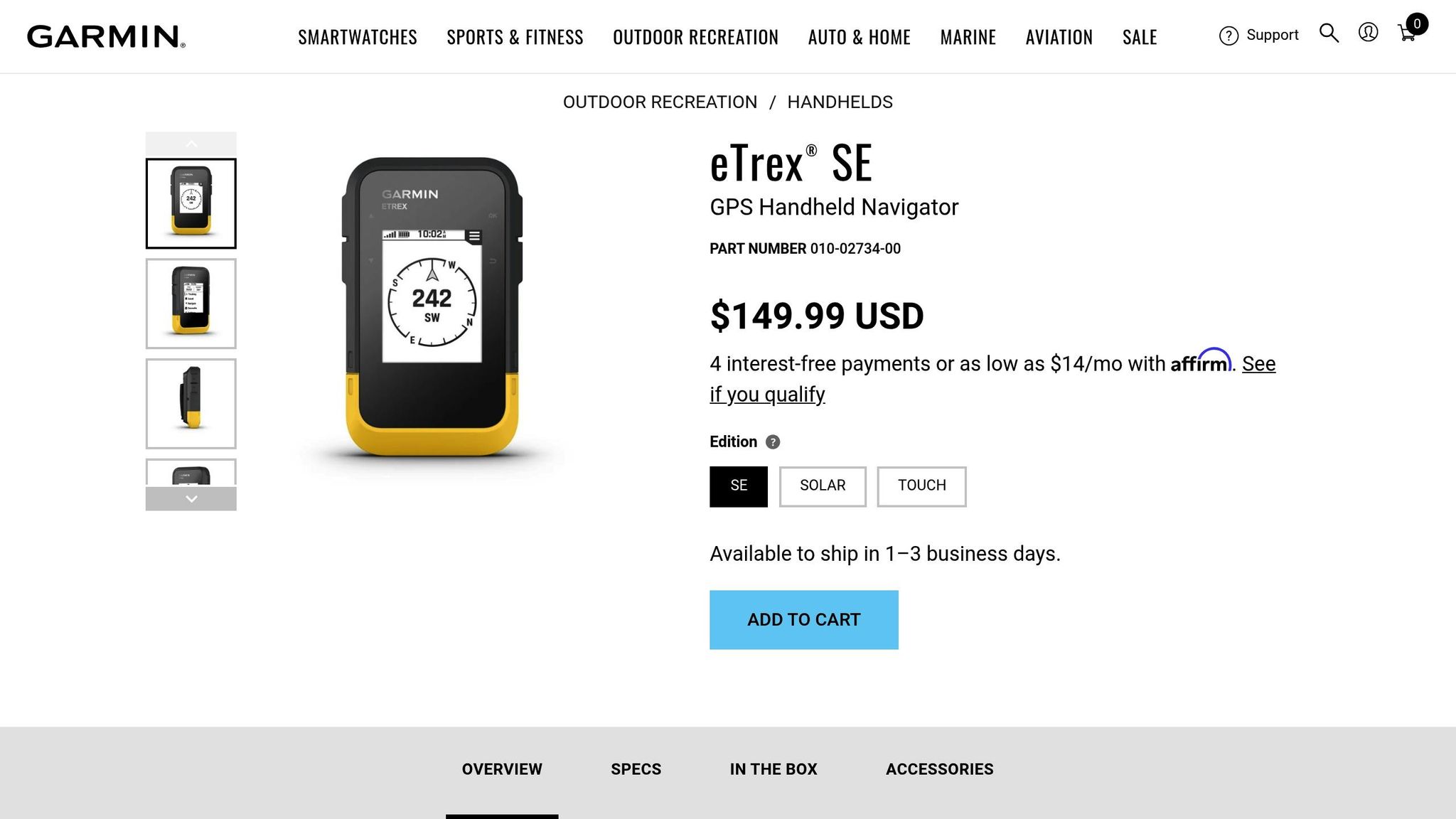
The Garmin eTrex SE offers reliable navigation at an affordable price of $150, making it a solid choice for beginners or as a backup device.
Navigation Accuracy and GNSS Support
This device supports five satellite systems – GPS, GLONASS, Galileo, QZSS, and BeiDou – providing broad global coverage. However, it doesn’t include multi-band technology, which limits its precision. The eTrex SE uses breadcrumb mapping to track your route and features an integrated digital compass for accurate heading. While it lacks built-in maps, connecting it to the Garmin Explore smartphone app via Bluetooth allows for full route planning and transfer capabilities.
"It lacks preloaded maps, but pairing it with the Garmin Explore app on your phone gives you full route planning and downloading capabilities." – Blaz, Outdoor Enthusiast, Nail the Trail
Battery Life (Standard and Expedition Modes)
Powered by two AA batteries, the eTrex SE delivers impressive longevity: up to 168 hours in standard GPS mode and a staggering 1,800 hours in expedition mode. That’s roughly 75 days of continuous use.
"With two AA batteries, the eTrex SE delivers up to 168 hours in standard mode and a staggering 1,800 hours in expedition mode." – GIS For Life
Durability and Water Resistance
Designed for tough outdoor conditions, the eTrex SE meets military-grade durability standards (MIL-STD-810). It’s built to handle drops, shocks, and harsh environments. With an IPX7 water resistance rating, it can survive submersion in up to 1 meter of water for 30 minutes. The device operates in extreme temperatures ranging from –4°F to 140°F (–20°C to 60°C) and weighs only 5.5 ounces with batteries. Its glove-friendly buttons ensure ease of use in wet or cold conditions.
Display Readability and Usability
The eTrex SE features a 2.2-inch monochrome display with a resolution of 240 x 240 pixels. The screen is high-contrast and easy to read in sunlight. While its button-based interface may feel outdated compared to modern touchscreens, it’s reliable in all weather conditions. With 28 MB of internal memory, the device can store a summer’s worth of routes and tracks.
GearJunkie rated the eTrex SE 6.5/10, and Amazon users gave it an average of 4.3 out of 5 stars from 267 reviews. Though it won’t replace high-end GPS units, the eTrex SE stands out as a lightweight and budget-friendly option for hikers looking for a dependable companion in 2025.
3. Garmin inReach Mini 2
Priced at $399.99, the Garmin inReach Mini 2 is designed for ultralight emergency communication. Weighing just 3.5 ounces – about the same as a bar of soap – it offers two-way satellite messaging and SOS capabilities.
Navigation Accuracy and GNSS Support
The inReach Mini 2 is equipped with a multi-GNSS chipset, which taps into GPS, Galileo, QZSS, BeiDou, and IRNSS satellite systems. This diverse satellite access allows for quicker position fixes compared to GPS-only devices, even in tough conditions like dense forests or narrow canyons. While it works from a pocket, it performs best with an unobstructed view of the sky. The device doesn’t include onboard topographic maps, instead offering breadcrumb trails, waypoints, and a TracBack feature. If a message struggles to send, creating a waypoint manually can help establish a connection.
"The Mini 2 won’t send until it gets a position fix. That’s where the new multi-GNSS chipset helps – by pulling from multiple satellite systems (GPS, Galileo, QZSS, BeiDou), it can usually lock a position fix much faster than the old GPS-only Mini." – Cris Hazzard, Professional Hiking Guide
This rapid satellite connectivity also contributes to the device’s impressive battery life.
Battery Life (Standard and Expedition Modes)
Under clear skies and 10-minute tracking intervals, the Mini 2 lasts up to 14 days. In expedition mode, with tracking set to 30-minute intervals, it can stretch to 30 days. However, battery life decreases in dense cover or freezing conditions. Tests in temperatures ranging from -5°F to 25°F revealed a 42% drop in performance, with 10-minute tracking lasting only 6–7 days. To extend battery life, consider lengthening tracking intervals, turning off Bluetooth when not in use, and disabling high-detail activity recording. The internal lithium-ion battery charges via USB-C in about 1 to 2.5 hours.
Durability and Water Resistance
The Mini 2 is built to handle tough environments. It meets MIL-STD-810 standards, making it resistant to extreme temperatures, shocks, and rough handling. With its IPX7 rating, it can survive being submerged in up to 3 feet of water for 30 minutes. In May 2024, reviewer Dean Krakel tested this by submerging the device in the icy waters of Blue Mesa Reservoir in Colorado, where it remained attached to a PFD and functioned without issue.
The physical button interface also stands out in extreme conditions. Between December 2025 and February 2026, outdoor expert JC Courtland tested the Mini 2 in Northern Michigan’s Manistee National Forest at -15°F. Unlike touchscreens, which often fail in such environments, the Mini 2’s buttons worked perfectly – even with gloves on.
"The Mini 2’s buttons worked perfectly while the Mini 3 required bare fingers… Physical buttons work with any gloves at any temp." – JC Courtland, Outdoor Gear Expert
Display Readability and Usability
While it doesn’t feature detailed maps, the Mini 2 focuses on reliable emergency messaging and basic tracking, making it appealing to ultralight adventurers.
Its 1.3-inch monochrome screen (176 x 176 pixels) is simple but easy to read in bright sunlight. However, typing messages directly on the device can be cumbersome without pairing it to a smartphone. For enhanced navigation and usability, it’s best to connect the device to the Garmin Explore app via Bluetooth.
The Mini 2 earned the Reader’s Favorite Gear of the Year Award in 2025 and received an 8.7/10 rating from GearJunkie. Keep in mind, though, that its satellite features require a subscription, starting at $14.95 per month with a one-time activation fee of $39.99. For hikers in need of dependable emergency communication in a lightweight design, the inReach Mini 2 remains a standout choice in 2025.
4. Garmin Montana 700
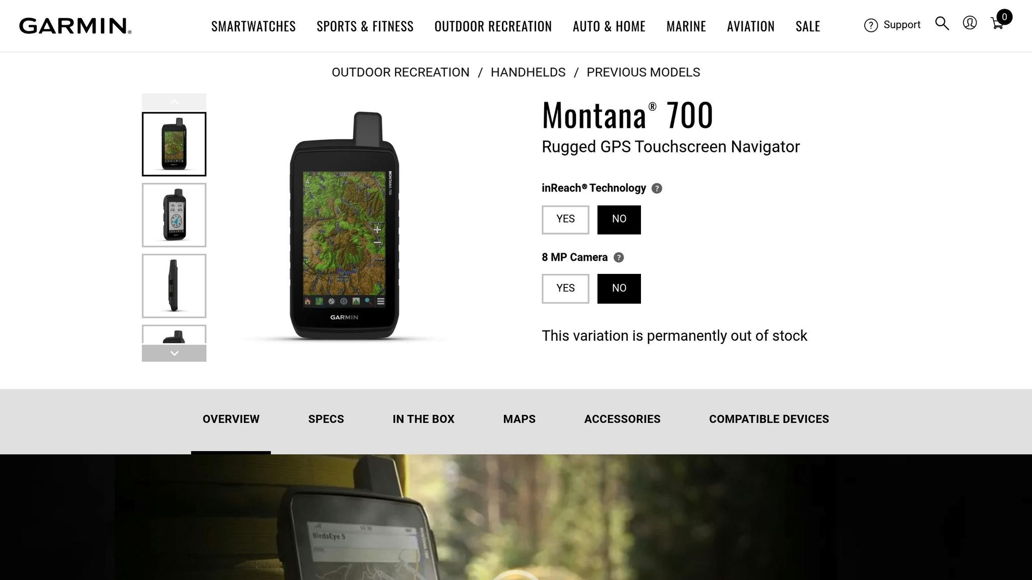
With a price tag of $599.99, the Garmin Montana 700 features a sizeable 5-inch touchscreen – 50% larger than its previous models. Weighing 14.5 ounces and equipped with a rechargeable lithium-ion battery, it’s a go-to choice for hikers, off-roaders, and overlanders who prioritize a detailed, larger display over a lightweight design.
Navigation Accuracy and GNSS Support
The Montana 700 supports GPS, GLONASS, and Galileo satellite systems, ensuring precise navigation even in challenging environments like deep canyons or dense forests. Field tests conducted by professional hiking guide Cris Hazzard revealed consistent accuracy between 8 and 12 feet, with rare deviations up to 25 feet in tough terrain.
"I’m getting 9 feet of accuracy here, which is pretty good. Most of the time it’s between 8-12 feet." – Cris Hazzard, Professional Hiking Guide
To maintain peak accuracy, it’s recommended to regularly calibrate the built-in 3-axis electronic compass and barometric altimeter.
Battery Life (Standard and Expedition Modes)
The Montana 700 offers up to 18 hours of battery life in standard GPS mode and an impressive 330 hours in Expedition mode. To stretch battery life further, reducing backlight brightness or disabling the display can help. For longer adventures, the device can also run on three AA batteries with an optional battery pack, providing a reliable backup when the rechargeable battery runs out.
This extended battery life pairs well with the device’s rugged design, discussed below.
Durability and Water Resistance
The Montana 700 meets MIL-STD-810 standards, making it tough enough to endure extreme temperatures ranging from –4°F to 140°F, as well as shocks and vibrations. With an IPX7 water rating, it can survive submersion up to 3 feet (about 1 meter) for 30 minutes. The Gorilla Glass-protected touchscreen is glove-compatible, though heavy rain might cause false inputs. Locking the screen prevents accidental touches in such conditions.
"This durable, water-resistant handheld is tested to U.S. military standards and features a glove-friendly 5" touchscreen." – Garmin
Display Readability and Usability
The Montana 700 combines rugged performance with advanced navigation tools, making it a standout for demanding outdoor activities. Its 5-inch transflective WVGA touchscreen offers excellent readability, even in bright sunlight, and its fast processor ensures smooth map rendering. The display is also glove-friendly, providing an intuitive navigation experience.
While the device’s size and weight might not appeal to minimalist hikers who prefer smaller, button-operated units, it shines in scenarios requiring detailed mapping and route planning. Garnering recognition as the "Best Large Screen" option, the Montana 700 is particularly well-suited for motorized adventures and situations where a large, clear display is essential.
5. Garmin Foretrex 801
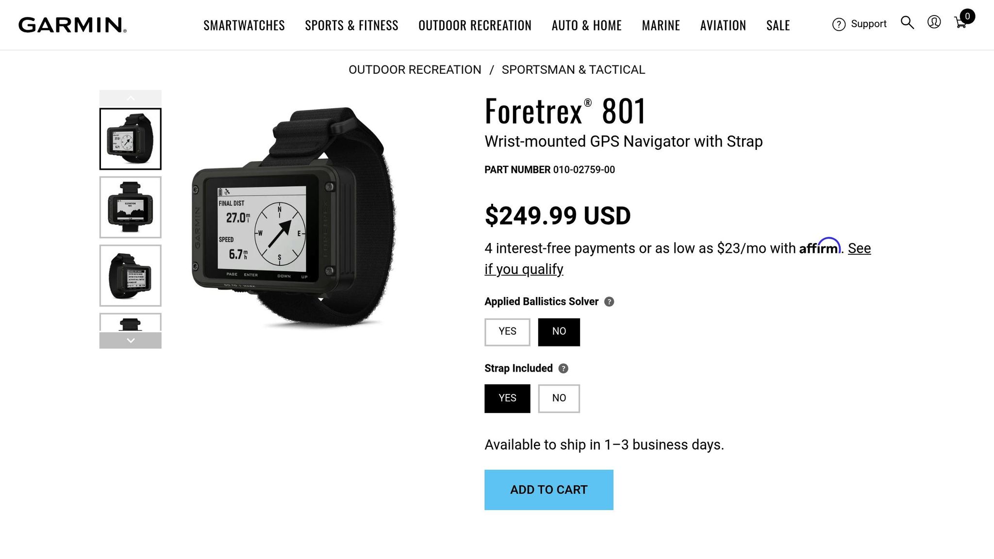
The Garmin Foretrex 801 stands out as a rugged, wrist-mounted GPS device designed for hands-free navigation, making it ideal for demanding environments like military operations and backcountry adventures.
At a price of $249.99, the Foretrex 801 offers a compact, watch-style format, weighing just 3.8 ounces with batteries. Unlike traditional handheld GPS units, this design prioritizes durability and simplicity, foregoing touchscreens and detailed maps for a more robust and straightforward experience.
Navigation Accuracy and GNSS Support
Equipped with upgraded multi-band GNSS support, the Foretrex 801 uses signals from GPS, GLONASS, and Galileo to deliver precise positioning, even in tough environments like dense forests or deep canyons. Instead of relying on preloaded maps or turn-by-turn directions, this device uses breadcrumb-style navigation, guiding users via waypoints, bearings, and headings.
"The GPS is incredibly accurate, and I have no problem finding very niche locations I mark for later – within feet!" – Verified Customer, Amazon
For tactical applications, it includes features like Stealth Mode, which disables wireless connectivity and logging, and a Kill Switch that erases all data instantly when the power button is pressed five times.
Battery Life (Standard and Expedition Modes)
Battery life is another strong suit of the Foretrex 801. It offers up to 100 hours in standard navigation mode and an impressive 1,000 hours in expedition mode. Powered by two replaceable AAA batteries (compatible with alkaline, lithium, or NiMH), it ensures minimal downtime by allowing users to quickly swap out batteries as needed.
Durability and Water Resistance
Built to meet MIL-STD-810 military standards, this GPS unit is designed to endure thermal shocks, physical impacts, and water exposure. Its IPX7 water resistance rating means it can survive submersion in up to 1 meter (about 3 feet) of water for 30 minutes, making it reliable in rain, snow, or extreme conditions. Users have praised its rugged construction, with one reviewer noting, "The unit itself is small and built like a tank".
Display Readability and Usability
The Foretrex 801 features a 2.2-inch monochromatic display, optimized for night vision goggles while remaining highly readable in bright sunlight. Although it lacks the color and detail of larger screens, the display is functional and easy to use, even with gloves or in wet conditions. Controlled by buttons, the interface may take some getting used to but proves dependable in challenging scenarios.
With a 4.7/5-star rating from 126 Amazon reviews and a 7.9/10 expert score from GearJunkie, the Foretrex 801 is a reliable choice for those needing hands-free operation and robust durability in demanding environments.
Device Comparison Table
The table below outlines key specifications for each model, helping you weigh your options based on features and performance.
| Device | Price | Weight | Battery Life (Standard / Expedition) | Screen Size | GNSS Support | Water Resistance | Storage |
|---|---|---|---|---|---|---|---|
| Garmin GPSMAP 67i | $599.99 | 8.1 oz | 180 hrs (standard) / up to 840 hrs (expedition, no tracking) | 3.0" Color | Multi-band (6 systems) | IPX7 / MIL-STD-810 | 16GB + microSD |
| Garmin eTrex SE | $150 | 5.5 oz | 168 hrs / 1,800 hrs | 2.2" Mono | Multi-GNSS (5 systems) | IPX7 | 28MB |
| Garmin inReach Mini 2 | $399.99 | 3.5 oz | 300 hrs (tracking) / 720 hrs | 1.3" Mono | GPS, Galileo, QZSS | IPX7 / MIL-STD-810 | 1,000 waypoints |
| Garmin Montana 700 | $599.99 | 14.5 oz | 18 hrs / 330 hrs | 5.0" Touch | GPS, Galileo | IPX7 / MIL-STD-810 | 32GB + microSD |
| Garmin Foretrex 801 | $249.99 | 3.8 oz | 100 hrs / 1,000 hrs | 2.2" Mono | Multi-band (3 systems) | IPX7 / MIL-STD-810 | 500 waypoints |
This breakdown showcases how each device caters to different outdoor needs, from lightweight portability to advanced mapping capabilities.
Prices range from $150 for the budget-friendly eTrex SE to $599.99 for the feature-packed GPSMAP 67i and Montana 700. Weight varies significantly, with the ultralight inReach Mini 2 at just 3.5 oz and the Montana 700 tipping the scales at 14.5 oz. Battery life is another standout factor, with the eTrex SE delivering up to an impressive 1,800 hours in expedition mode, while the Montana 700 offers a more modest 18 hours in standard use.
High-end models like the GPSMAP 67i and Montana 700 come with preloaded TopoActive maps and generous storage (16GB or more). On the other hand, lighter or more affordable options like the eTrex SE, inReach Mini 2, and Foretrex 801 focus on breadcrumb navigation or smartphone integration for map details. For those venturing into dense forests or areas with poor satellite visibility, the GPSMAP 67i and Foretrex 801 stand out with multi-band GNSS technology, providing pinpoint accuracy within 8–10 feet, compared to older devices that can drift by over 30 feet.
Additionally, four models – the GPSMAP 67i, inReach Mini 2, Montana 700, and Foretrex 801 – are built to withstand the toughest conditions, meeting MIL-STD-810 standards for thermal shock, physical impacts, and extreme weather.
Conclusion
Choosing the right GPS device depends on your hiking style and environment. For those venturing into dense forests or slot canyons, multi-band models like the GPSMAP 67i or Foretrex 801 deliver accuracy within 8–12 feet, while standard single-band units may drift by over 30 feet. If you’re sticking to well-trodden paths and watching your budget, the eTrex SE is a solid option. At $150, it offers reliable breadcrumb navigation and an impressive 1,800-hour battery life in expedition mode.
It’s not just about pinpoint accuracy – practical considerations like weight and battery life matter, especially on longer trips. For ultralight enthusiasts, the inReach Mini 2 weighs a mere 3.5 ounces and provides essential satellite communication, making it a great choice for solo adventurers. On the other hand, the Montana 700, with its 5-inch touchscreen, is better suited for vehicle-based exploration, though its 14.5-ounce weight may be a drawback for backpackers. Keep in mind that satellite messaging features come with monthly subscription costs.
As seasoned backpacker Sean Nelson points out:
"A phone isn’t a substitute for a dedicated GPS in backcountry conditions – I’ve seen phones shut down at 15°F, drain batteries in 4 hours, and screens become unreadable in direct sun." – Sean Nelson, Backpacking Expert
Before heading out, test your device at home. For button-based models, ensure they work well with gloves and in freezing temperatures. If you’re planning extended trips, consider units with replaceable AA batteries, as they often outperform internal lithium-ion batteries in remote settings.
For more hiking tips and gear insights, check out Adventurism.co. Whether you’re out for a day hike or a multi-week adventure, a GPS device priced between $150 and $600 can be a crucial backup when your phone fails.
FAQs
Do I need multi-band GNSS for hiking?
Multi-band GNSS is a great choice for hiking because it provides more accurate and reliable positioning, even in tough environments like dense forests or remote locations. By tapping into multiple satellite constellations, it minimizes signal disruptions and enhances navigation in areas where standard GPS might fall short.
What GPS works best in cold weather?
The Garmin GPSMAP 67 stands out for its user-friendly design and dependable functionality, even in extremely cold weather. It’s a reliable option for hikers tackling tough winter conditions.
What extra costs come with satellite messaging?
Satellite messaging comes with extra costs, such as subscription fees for service plans, which can be billed monthly or annually. Sometimes, there’s also a one-time activation fee for the device. It’s a good idea to carefully check the pricing details for both the device and the service plan you select to steer clear of unexpected charges.